from: 1016 Map Inventory
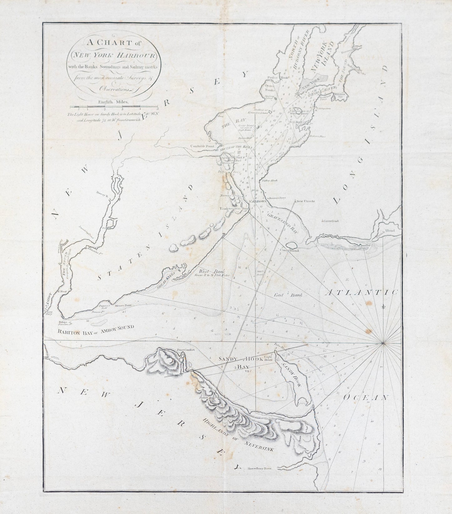
Mark Tiddeman. A Chart of New York Harbour..., 1780.
Mark Tiddeman. A Chart of New York Harbour..., 1780.
Couldn't load pickup availability
Mark Tiddeman (active 18th century)
A Chart of New York Harbour...
From The English Pilot, Book IV, London, 1780
Engraved map on paper
[Sheet size: 26 1/2 x 23 in.]
This finely engraved maritime chart by Mark Tiddeman presents one of the most important colonial-era depictions of New York Harbor, published in 1780 at the height of the American Revolutionary War. Issued in The English Pilot, Book IV, a crucial navigational atlas for British seafarers, the map details the approaches to New York with exceptional precision—highlighting sandbanks, depth soundings, anchorage points, and coastal features vital to navigation. Tiddeman’s chart not only reflects British strategic interests in one of the most hotly contested ports of the war, but also captures the pivotal role of cartography in imperial ambition and maritime warfare.