
Blaeu, Johannes and Cornelius. Novam Hanc TERRITORII FRANCOFURTENSIS Tabulam. Amsterdam, c. 1640s.
Blaeu, Johannes and Cornelius. Novam Hanc TERRITORII FRANCOFURTENSIS Tabulam. Amsterdam, c. 1640s.
Regular price
$ 2,400.00 USD
Regular price
Sale price
$ 2,400.00 USD
Unit price
per
Couldn't load pickup availability
Johannes and Cornelius Blaeu
Novam Hanc TERRITORII FRANCOFURTENSIS Tabulam
Amsterdam, c. 1640s
20" x 23"
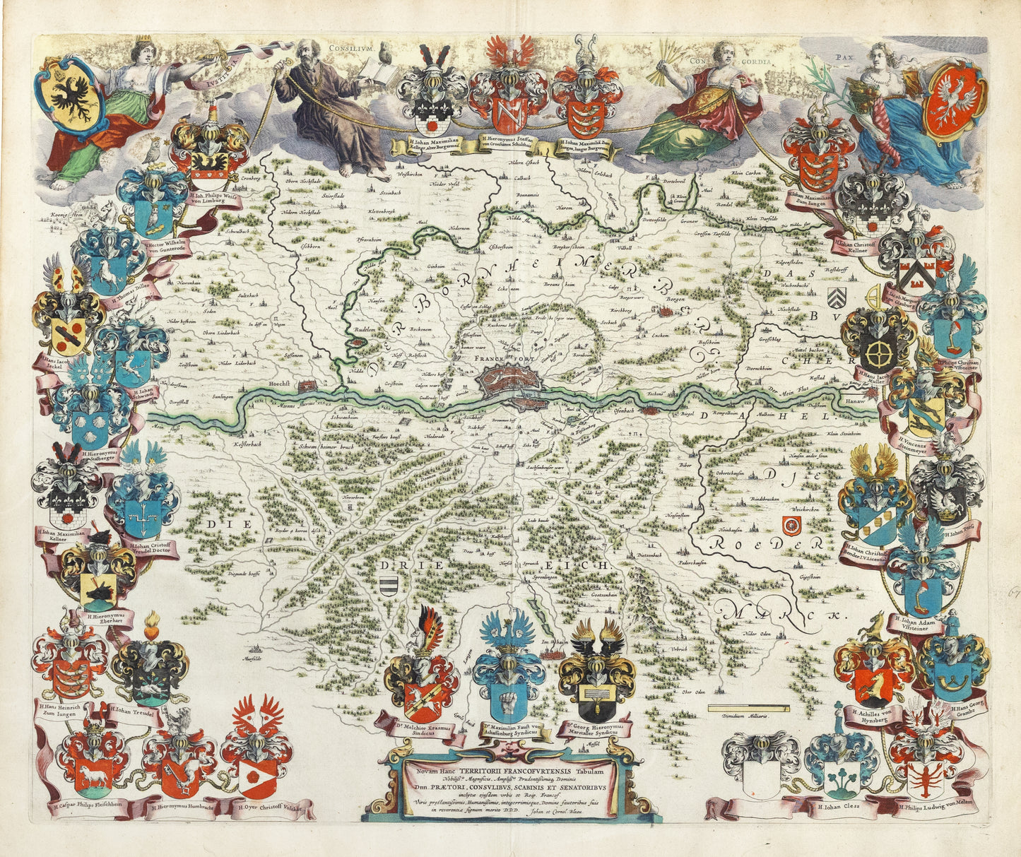
This stunning map of Frankfurt, Germany is produced by the formeost cartographer of the 17th century, Johannes Blaeu. Surrounded by the intricate coat of arms of several dignitaries of the Frankfurt area and surmounted by the four allegorical figures representing Iustitia (Justice), Consilium (Counsel), Concordia (Concord) and Pax (Peace), this very detailed map extends as far west as Hoechst, Hanau in the east, Imhaim in the south and Nidern Esbach in the north. This is unquestionably the most decorative of Blaeu's many regional maps.
-
Example product title
Regular price $ 2,400.00 USDRegular priceUnit price per -
Example product title
Regular price $ 2,400.00 USDRegular priceUnit price per -
Example product title
Regular price $ 2,400.00 USDRegular priceUnit price per -
Example product title
Regular price $ 2,400.00 USDRegular priceUnit price per