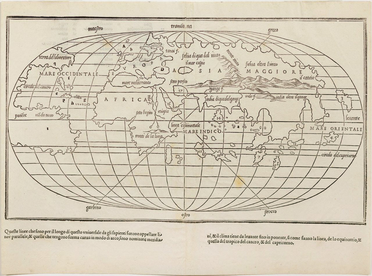
Benedetto di BORDONE (1460-1531) [World Map]. 1547.
Benedetto di BORDONE (1460-1531) [World Map]. 1547.
Couldn't load pickup availability
Benedetto di BORDONE (1460-1531)
[World Map]
Venice, 1528/1547
Double-page woodcut world map on an oval projection from Bordone’s “Isolario”
Sheet: 11 1⁄4” x 15”
This early and influential world map by Benedetto di Bordone reflects the evolving European understanding of global geography during the Age of Exploration. Originally published in Isolario, a groundbreaking collection of island maps and descriptions, the map captures the spirit of discovery in the early 16th century, as explorers expanded European knowledge of the Americas, Africa, and Asia.
Bordone’s map is notable for its simplified, oval-shaped projection, which presents the world in a style distinct from the Ptolemaic tradition, reflecting the geographic advancements of the Renaissance. It highlights Europe, Africa, and Asia, while the Americas appear in a rudimentary form, illustrating the continent’s recent discovery and the incomplete knowledge of its extent.
Produced in Venice, a major center of printing and trade, this map exemplifies the dissemination of geographic knowledge in the early modern world. It stands as a landmark in cartographic history, bridging medieval traditions and the scientific developments that would define modern mapmaking.
![Benedetto di BORDONE (1460-1531) [World Map]. 1547.](http://aradernyc.com/cdn/shop/files/MAPH0013.jpg?v=1733956518&width=1445)

