from: 1016 Map Inventory
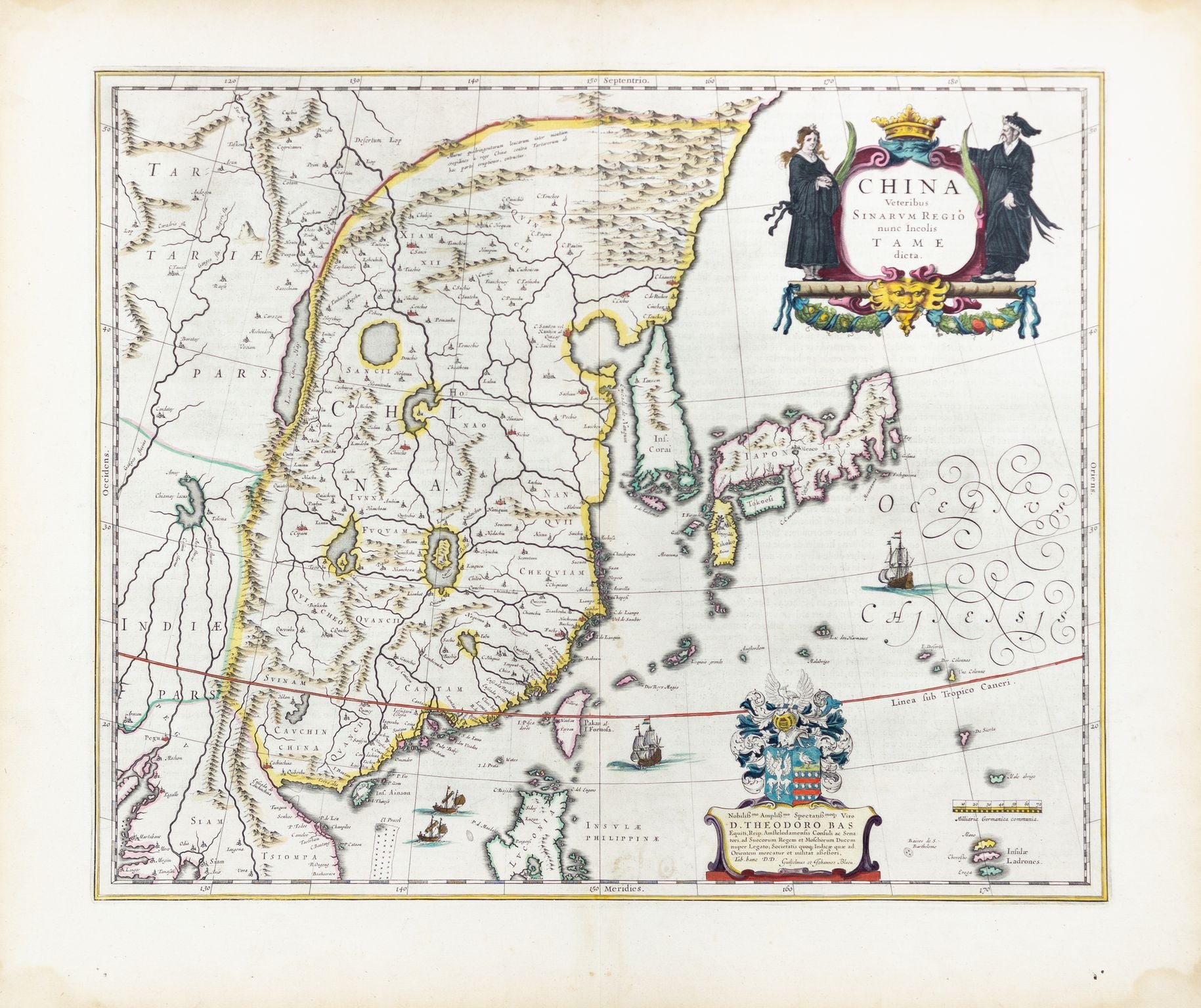
Bas, D. Theodoro. China Veteribus Sinaravm Regio nunc Incolis Tame dicta. Amsterdam, 1650s.
Bas, D. Theodoro. China Veteribus Sinaravm Regio nunc Incolis Tame dicta. Amsterdam, 1650s.
Couldn't load pickup availability
D. Theodoro Bas
China Veteribus Sinaravm Regio nunc Incolis Tame dicta
Amsterdam, 1650s
20 1/2 x 16 inches
The map titled "China Veteribus Sinarum Regio nunc Incolis Tame dicta" is a highly detailed and ornately decorated depiction of China, created in the 1650s. It reflects the geographic knowledge of China as understood by European cartographers during the mid-17th century. The map is not just a geographical representation but also an artistic artifact, showcasing the cartographer's skill in both cartography and the art of engraving.
The map presents China with considerable detail, including major cities, rivers, and mountain ranges, as well as some bordering regions. Notably, the map is embellished with elaborate cartouches and ships, characteristic of the Baroque style that was prevalent in cartography during this period. The title of the map refers to "China as it was known to the ancient Chinese, now called by the inhabitants Tame," indicating a blend of classical knowledge with contemporary understanding.
The historical significance of this map lies in its role as a European interpretation of China during the era of exploration and early global trade. During the 17th century, European interest in Asia was at its peak, driven by the expansion of trade routes, particularly through the Dutch East India Company. This map would have been valuable for merchants, explorers, and scholars who sought to understand and navigate the complex and distant regions of East Asia. Furthermore, it reflects the broader European fascination with and desire to categorize and understand the wider world, including places as far removed as China.
**Biography of the Mapmaker: D. Theodoro Bas**
D. Theodoro Bas was a notable cartographer and engraver based in Amsterdam during the mid-17th century. While not as widely known as some of his contemporaries, Bas contributed significantly to the cartographic output of his time, especially within the context of Amsterdam, which was a major center of mapmaking due to the city's importance in global trade.
Bas is often associated with the production of maps that were both practical tools for navigation and trade and decorative objects of art. His work reflects the high level of craftsmanship that was typical of Dutch cartographers, combining precise geographical information with elaborate artistic elements.
Although details about Bas's life are relatively scarce, his work is characterized by a meticulous attention to detail and a deep understanding of the geographical knowledge available in Europe during his lifetime. His maps are valued today not only for their historical content but also for their artistic quality, making them prized items among collectors and historians alike.
The map "China Veteribus Sinarum Regio nunc Incolis Tame dicta" stands as a testament to Bas's skill and the broader European endeavor to map and understand the world during the Age of Discovery.
