from: Maps
Waldseemuller, Martin (c. 1470-1520). Tabula Moderna Italie. Strassbourg, 1513
Waldseemuller, Martin (c. 1470-1520). Tabula Moderna Italie. Strassbourg, 1513
Couldn't load pickup availability
Martin Waldseemuller (c. 1470-1520)
Tabula Moderna Italie
Woodcut map
Strassbourg: 1513
17 1/2” x 23 1/4” sheet
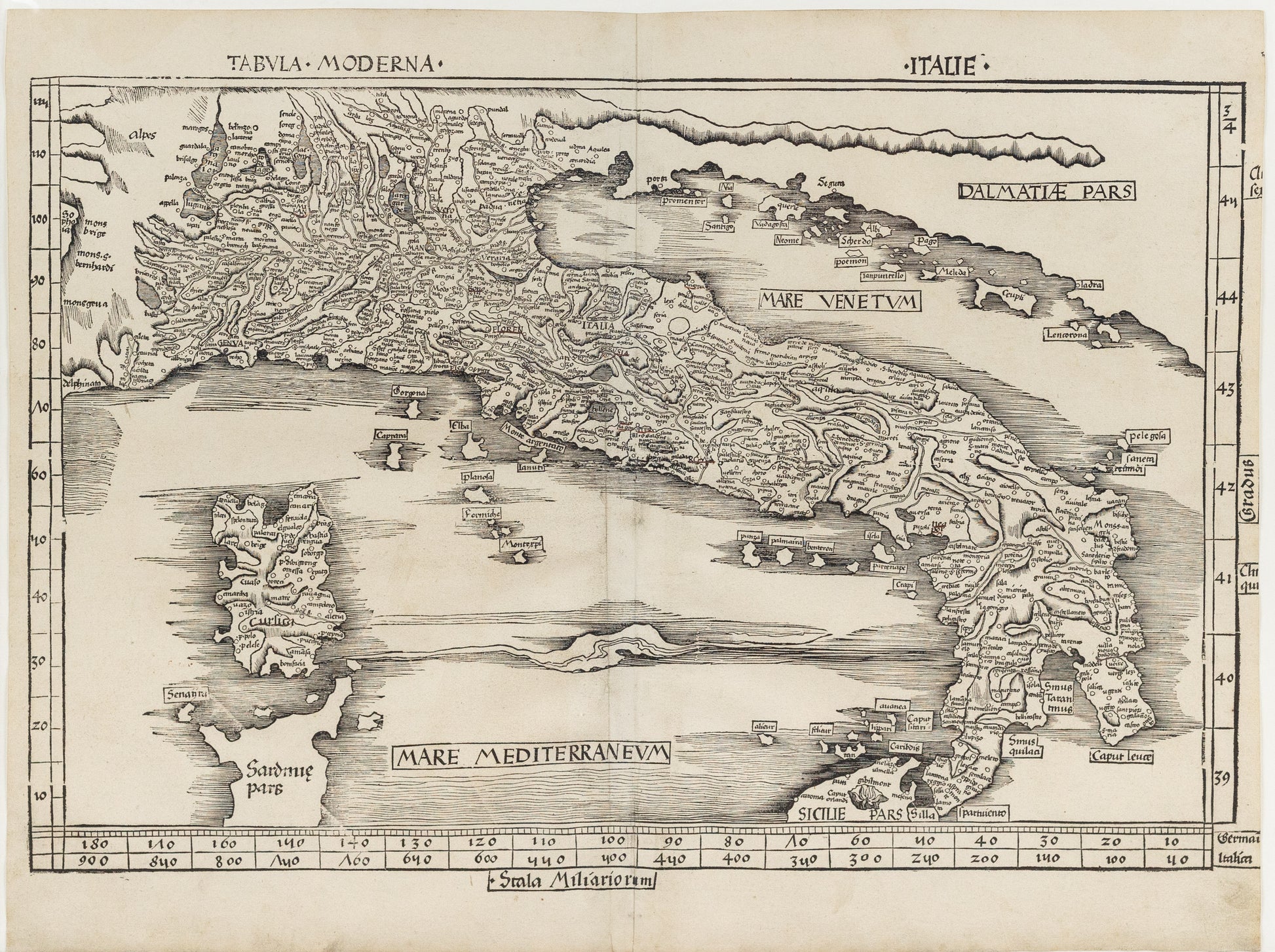
Ptolemy’s First Modern Map of Italy
One of the earliest maps of Italy based on modern top- onymy rather than classical place names. The present map of Italy is part of the Supplementum Modernior which Nordenskiold calls the first modern atlas of the world. Waldseemüller in the introduction to his Pars Secunda: “We have confined the Geographia of Ptolemy to the first part of the work, in order that its antiquity may remain intact and separate”.
Claudius Ptolemaeus was a second-century philosopher living in Roman Alexandria in Egypt. In the Greek tradition (Ptolemy wrote in Greek, which was the administrative language of the Roman Empire in the Eastern Mediterranean), philosophy — the love of wisdom — bridged what we now divide into the humanities and the sciences; he was a mathematician, natural scientist and geographer-astronomer. No manuscripts of the Geographical Guidance survive from before the 13th century, but some 13th century examples survive with maps that bear some relation to those Ptolemy himself drew. Thus, with the exception of some excavated carved maps, Ptolemy is the source for ancient cartography as well as its culmination.
Florence was the port of entry for the Greek text in Europe (ca. 1400), and almost immediately it was translated into Latin, which was much more widely understood. Various translations circulated, but Ringmann’s is generally regarded as superior to his predecessors’. In the 15th century, the Geographia was the core of ancient knowledge of the world, extending from the Canary Islands in the West to China in the East (though not quite to the Pacific), Scandinavia in the North and beyond the Horn of Africa to the South. It was crucial to explorers; Columbus expected to find the East Indies because of Ptolemy’s calculations and assertion about longitude.
As the world expanded beyond its ancient bounds, discoveries were integrated into the Ptolemaic maps, distinct with their trapezoidal frames. With funding from René II, Duke of Lorraine, Walter Lud, canon in St-Dié-des-Vosges, gathered a group of humanists to knit together the new knowledge coming from Christopher Columbus and other early explorers with a new translation (Ringmann) and new maps (Waldseemüller). Together they revolutionized cartography, and were likely responsible with the coinage of America and a description of the New World.
