from: Maps
WALDSEEMULLER, Martin (1470-1520). Orbis Typus Universalis luxta. 1513
WALDSEEMULLER, Martin (1470-1520). Orbis Typus Universalis luxta. 1513
Couldn't load pickup availability
Martin WALDSEEMULLER (1470-1520)
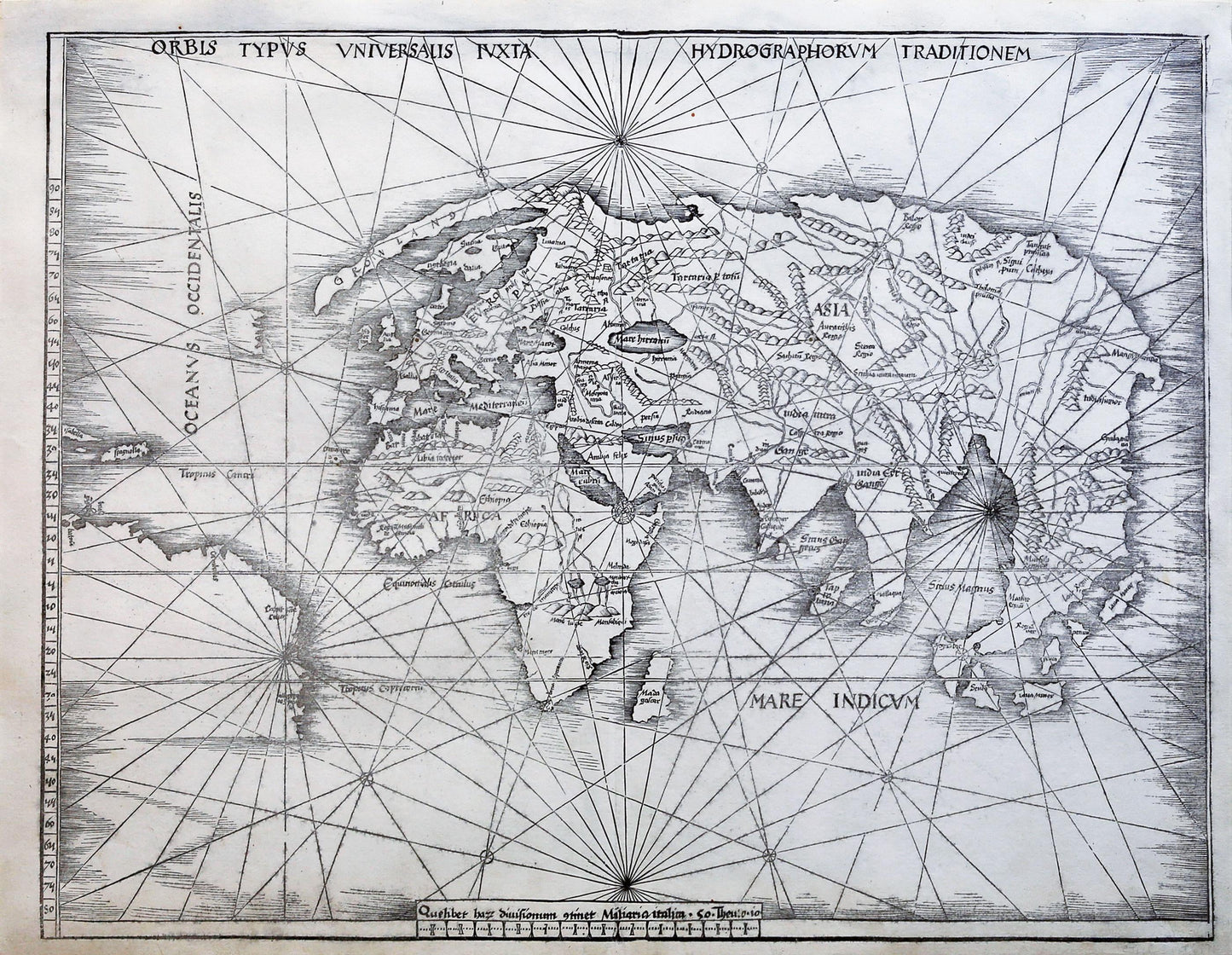
Orbis Typus Universalis Iuxta Hydrographorum Traditionem
Strassburg, 1513
Sheet: 18 1⁄4 x 25 inches; framed: 27 1⁄2 x 33 1⁄2 inches
Woodcut map from “Claudii Potelemei...Geographiae opus novissima...”
The Strassburg Ptolemy of 1513 was the work of Martin Waldseemuller, the scholar and geographer whose extraordinary 1507 world map exists today in a single copy. This edition perfectly reflects the state of cartography in 1513, since it ombines 27 classical Ptolemaic maps with 20 “modern” maps of the world’s new Discoveries.
In addition to a Ptolemaic world map, Waldseemuller included this modern map. Waldseemuller’s introduction by his colleague Mathias Ringmann described the map as reflecting the voyages of “the Admiral” (Christopher Columbus), so this map is often called the “Admiral’s Map.” The map is among the first to acknowledge the existence of the Americas and to include all of Africa. It also included an updated coastline of Asia and an improved shape for India.
These updates notwithstanding, it was somewhat outdated on its publication, with many details of the Americas omitted that were known to mapmakers by 1513. In fact, details of Africa and Asia that appear in Waldseemuller’s own regional maps in the same work are not present in the world map. Shirley conjectures that the map was likely drawn in 1505-06 and then set aside until published.
Despite its omissions, the map was popular and highly influential, perhaps because it was familiar to those used to seeing the world as Ptolemy described it.
References: Shirley 35. Harrisse 97.