from: Maps
COLTON, ROESSLER & PRESSLER. Colton's New Map of the State of Texas The Indian Territory... 1882
COLTON, ROESSLER & PRESSLER. Colton's New Map of the State of Texas The Indian Territory... 1882
Couldn't load pickup availability
COLTON, George Woolworth & Charles B. (publisher) & ROESSLER, Anton R. and PRESSLER, Charles W. et. al. (cartographers)
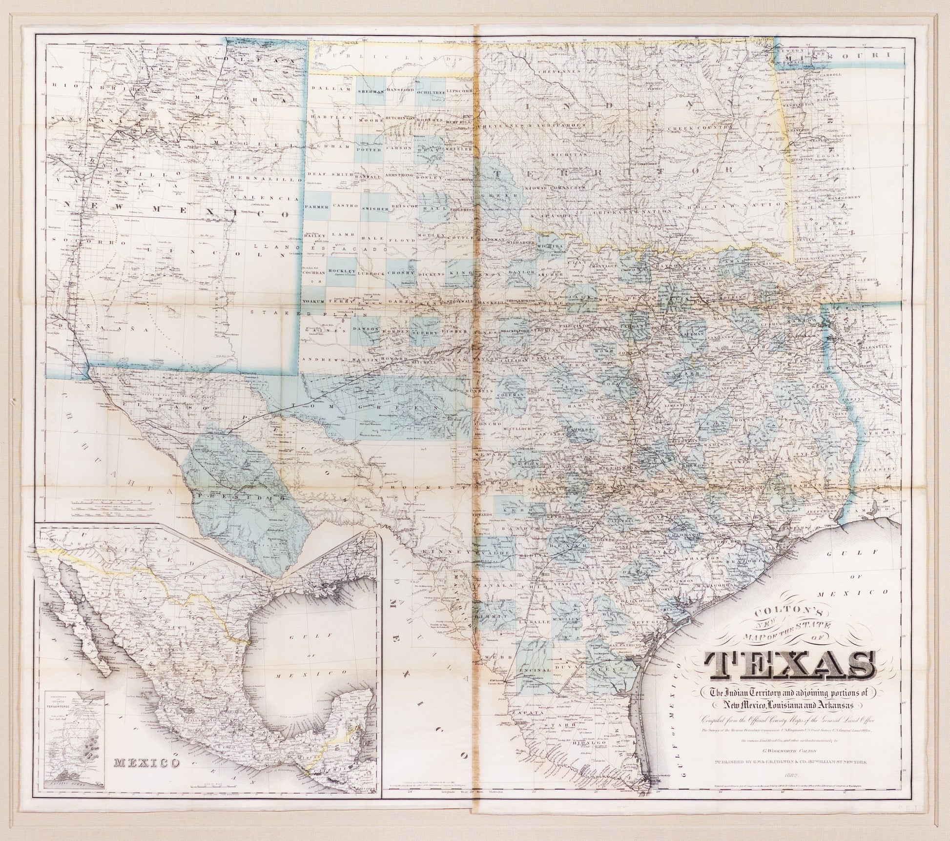
Colton's New Map of the State of Texas The Indian Territory and adjoining portions of New Mexico, Louisiana and Arkansas. Compiled from the official county maps of the General Land Office The Surveys of the Mexican Boundary Commission U.S. Engineers U. S. Coast Survey U.S. General Land Office, the various Rail Road Co's and other authentic materials by G Woolworth Colton
Lithograph map with original color
New York: 1882
The last cartographic descendent of De Cordovo’s 1856 map, displaying in graphic form the state’s explosive growth in population, transportation, and political subdivisions in the ensuing 26 years. Among the first truly “modern” maps of Texas.
