from: Maps
Braun & Hogenberg, [Norwich, England] Nordovicum Angliae Civitas
Braun & Hogenberg, [Norwich, England] Nordovicum Angliae Civitas
Couldn't load pickup availability
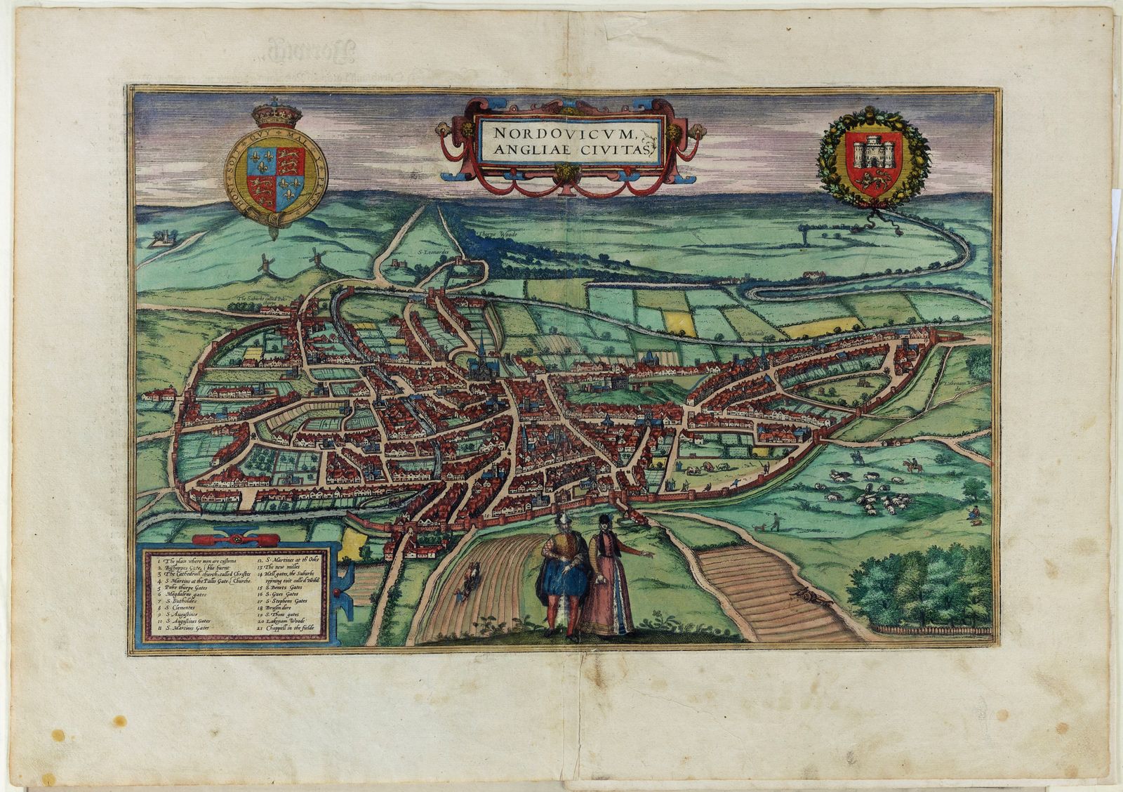
BRAUN, Georg (1541-1622) & HOGENBERG, Frans (1535-1590).
[Norwich, England] Nordovicum Angliae Civitas
Engraved map with original hand color.
From Civitas Orbis Terrarum, Cologne, c. 1588.
16 3/8" x 21 1/8" sheet.
A finely detailed bird’s-eye view of Norwich, one of England’s most important medieval cities, from Braun and Hogenberg’s monumental Civitas Orbis Terrarum—the first modern atlas of city views. Rendered with meticulous attention to the city’s streets, fortifications, and cathedral, this engraving captures Norwich at the height of its prosperity as a center of the wool trade. Figures in Elizabethan dress, a decorative cartouche, and heraldic arms enhance the map’s visual and historical richness. A rare and beautifully hand-colored example of early English urban cartography.
![Braun & Hogenberg, [Norwich, England] Nordovicum Angliae Civitas](http://aradernyc.com/cdn/shop/files/111.jpg?v=1752266582&width=1445)