from: Maps
Braun & Hogenberg, [Saltzburak]. 1588
Braun & Hogenberg, [Saltzburak]. 1588
Couldn't load pickup availability
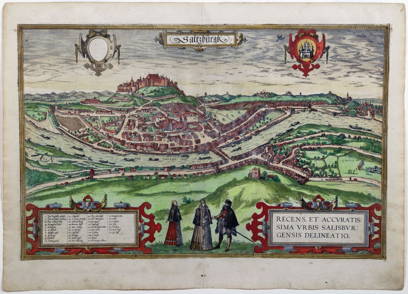
BRAUN, Georg (1541–1622) & HOGENBERG, Frans (1535–1590)
Saltzburak
From Civitas Orbis Terrarum, Cologne, c. 1588
Engraved map with original hand color
Sheet size: 16 1/2 x 21 inches
A richly detailed bird’s-eye view of Salzburg, this engraving by Braun and Hogenberg captures the city’s medieval skyline nestled between dramatic alpine ridges. Dominated by the imposing Hohensalzburg Fortress and the spires of early ecclesiastical architecture, the image offers a rare glimpse of the city as it appeared in the late 16th century—then a powerful ecclesiastical principality of the Holy Roman Empire. Decorative flourishes such as costumed figures in the foreground, detailed rendering of rooftops, and a Latin cartouche lend the print both geographic accuracy and Renaissance artistry. Published in the monumental Civitas Orbis Terrarum, the first comprehensive atlas of city views ever produced, this engraving is a testament to the era’s blend of humanist scholarship and cartographic innovation.
![Braun & Hogenberg, [Saltzburak]. 1588](http://aradernyc.com/cdn/shop/files/austria.jpg?v=1752875218&width=1445)