A MONUMENTAL WALL MAP OF EARLY 19TH-CENTURY AMERICA, PUBLISHED THE YEAR THE ERIE CANAL OPENED
LLOYD'S MAP OF THE SOUTHERN STATES
MILITARY MAP OF TEXAS, 1857 - RARE FIRST EDITION
Detailed Wall Map of United States during the Civil War
1855 Wall Map of US and Mexico
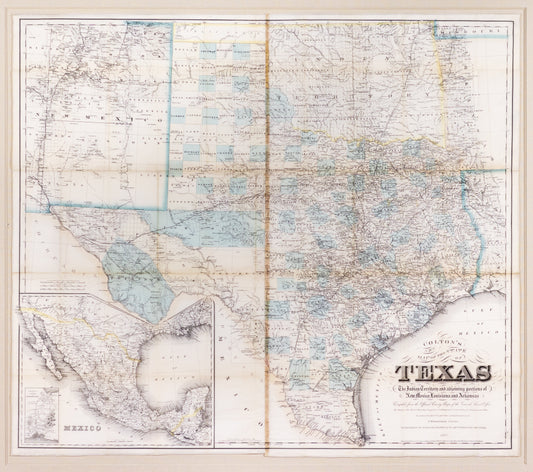
COLTON, ROESSLER & PRESSLER. Colton's New Map of the State of Texas The Indian Territory... 1882
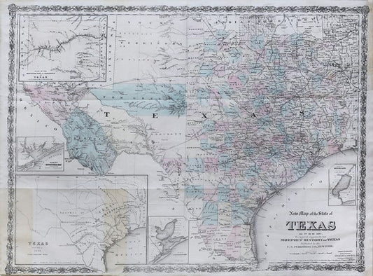
G.W. & C.B. COLTON AND CO. New Map of the State of Texas as it is in 1875.
United States General Land Office (Theodore Franks, Draftsman) Map of the United States and Territories. 1866
LE ROUGE, George Louis de (1707-c. 1790), after John Mitchell (1711-1768) Amerique Septentrionale avec les routes distances en miles villages et establissments francois et anglais...1756