from: The History of Canada
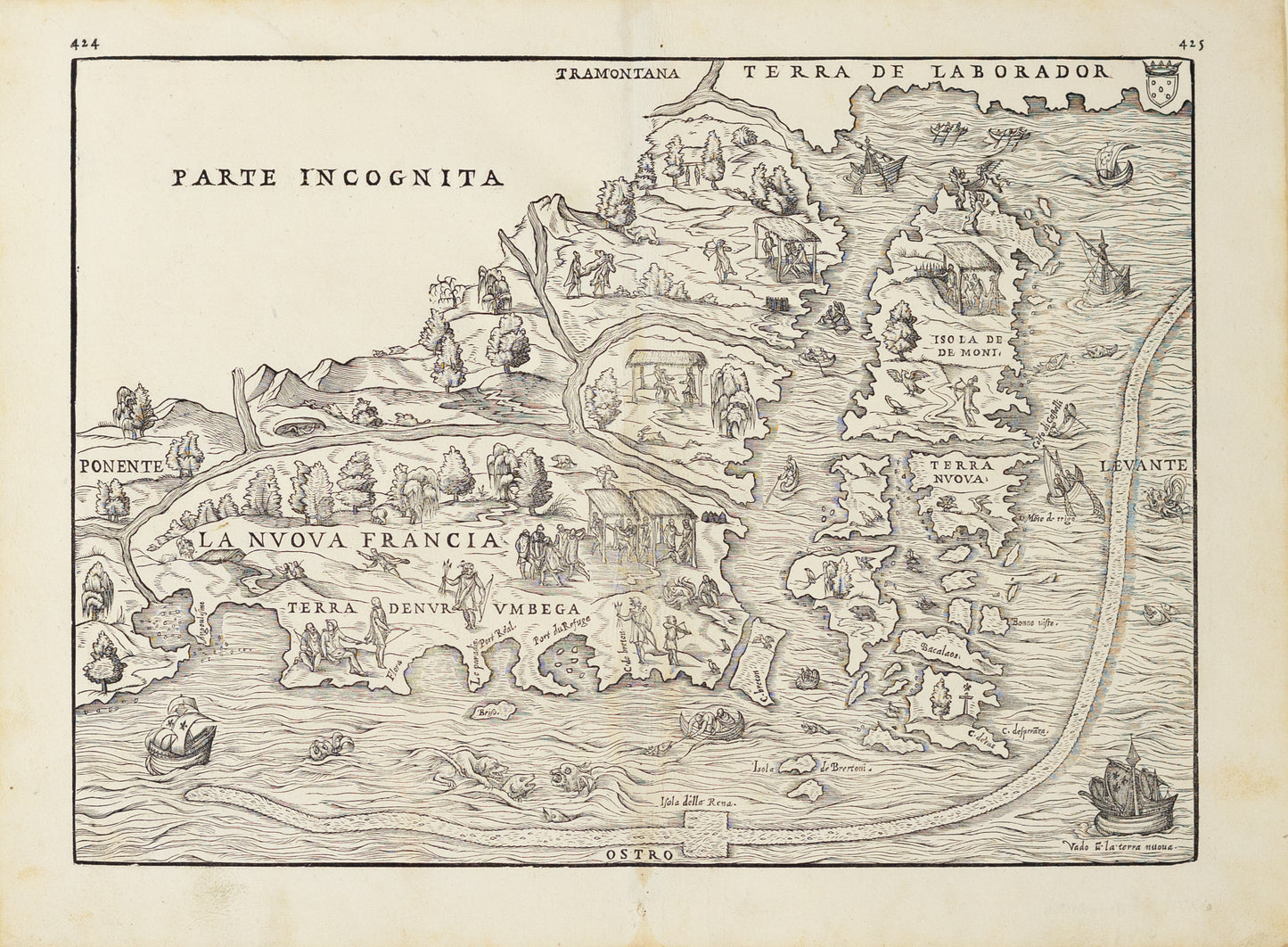
Giovanni Battista Ramusio. La Nuova Francia. Venice, 1565.
Giovanni Battista Ramusio. La Nuova Francia. Venice, 1565.
Couldn't load pickup availability
Giovanni Battista Ramusio (Italian, 1485–1557)
La Nuova Francia
Venice, 1565
Woodcut on paper
[Sheet size: 12 x 15 1/2 in.]
This 1565 woodcut map of La Nuova Francia (New France), published in Venice by Giovanni Battista Ramusio, stands as one of the earliest printed European depictions of northeastern North America. Based on reports from explorers such as Jacques Cartier, the map reflects the dawning European awareness of the St. Lawrence River valley and the lands that would become Canada. Issued in Ramusio’s seminal Navigationi et Viaggi, a foundational collection of early voyage accounts, the map is emblematic of the Renaissance thirst for global knowledge and territorial ambition. It blends rudimentary geographic information with mythic elements, offering a fascinating glimpse into the cartographic imagination of 16th-century Europe.