from: Maps of Europe
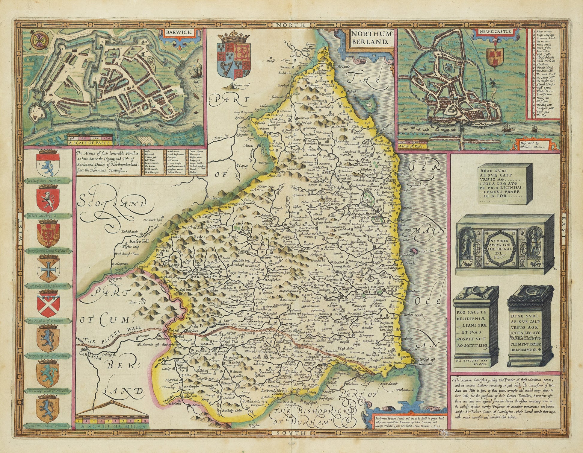
John Speed. Northumberland, 1610. [England]
John Speed. Northumberland, 1610. [England]
Couldn't load pickup availability
John Speed (1552–1629)
Northumberland [England]
London, 1610
Engraving with hand color
[Sheet size: 17 x 21 in.]
John Speed’s map of Northumberland, published in 1610 as part of his monumental Theatre of the Empire of Great Britaine, is among the earliest detailed county maps of England. Combining cartographic precision with rich decorative elements, this map illustrates not only the geography of Northumberland but also its historical identity—complete with coats of arms, battle scenes, and inset town plans (including a detailed view of Newcastle upon Tyne). Speed’s work was the first comprehensive atlas of the British Isles and a defining achievement in English mapmaking, reflecting both rising national pride and a deepening interest in regional identity during the early Stuart period.
![John Speed. Northumberland, 1610. [England]](http://aradernyc.com/cdn/shop/files/MB0430.jpg?v=1745356828&width=1445)