ROBINSON, John Hamilton (1782-1819) A Map of Mexico, Louisiana and the Missouri Territory...1819
ROBINSON, John Hamilton (1782-1819) A Map of Mexico, Louisiana and the Missouri Territory...1819
Couldn't load pickup availability
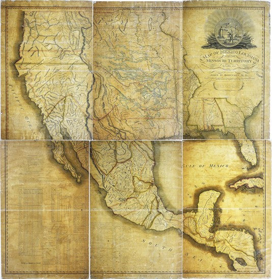
ROBINSON, John Hamilton (1782-1819)
A Map of Mexico, Louisiana and the Missouri Territory, also including the State of Mississippi, Alabama Territory, East and West Florida, Georgia, South Carolina and part of the Island of Cuba.
Engraved map with original hand outline color on twelve sheets joined as six and backed on linen
Philadelphia: Printed by John L. Narstin, 1819
Overall 70 x 67 1/2 inch sheet
Soldier, doctor, explorer, diplomat, spy, revolutionary and mapmaker: John Hamilton Robinson epitomized the adventurers of his age. One of only 7 known examples known, this map came from the collections of the Library of Congress, sold by them to Thomas Winthrop Streeter as a duplicate. Three were deposited with the Library to establish Robinson’s copyright