ANONYMOUS. Map of Suruga Province
ANONYMOUS. Map of Suruga Province
Couldn't load pickup availability
Anonymous
Map of Suruga Province
Original pen and ink and watercolor map on
several sheets of washi paper
71” x 68” combined sheet;
75” x 72” framed
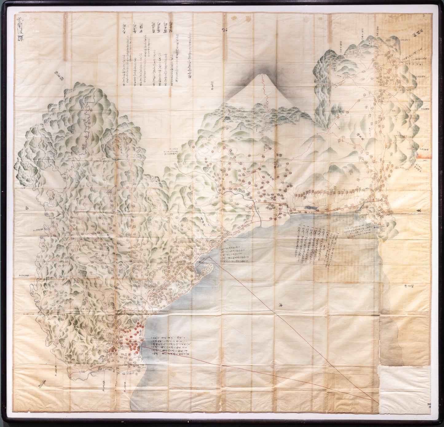
Manuscript map of Suruga Province, featuring Mount Fuji, and showing significant villages and other notable landmarks, calligraphic notations in the margins and throughout detail the local economy.
A fascinating and important map of Suruga province (present day Shizuoka and
parts of Yamanashi and Kanagawa prefectures) showing the seven prefectureS of Suruga: Shida, Mashizu, Abe, Udo, Ihara, Fuji, and Sunto, with a magnificent view Mount Fuji and surrounding foothills. This giant provincial map was mostly produced for use as an economic report from the Japanese lords (daimyo) to promulgate the decisions of the Shogunate in Edo. Given its monumental size and multidirectional text, it is understood that Shogunate leaders likely viewed these maps standing from above, in large tatami mat ceremonial rooms at Edo Castle. Place names are denoted within round labels with red and yellow wash, while main roads and routes to the shogunal court are marked in
red vermillion paint, a mapmaking practice derived from China.