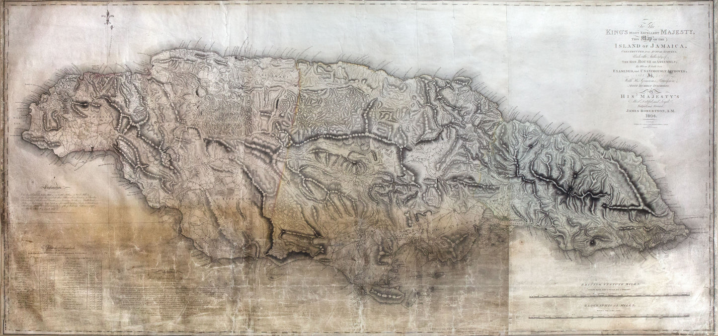
James Robertson. To the King's Most Excellent Majesty, This Map of the Island of Jamaica... London, 1804.
James Robertson. To the King's Most Excellent Majesty, This Map of the Island of Jamaica... London, 1804.
Regular price
$ 18,000.00 USD
Regular price
Sale price
$ 18,000.00 USD
Unit price
per
Couldn't load pickup availability
James Robertson (1753-1829)
To the King's Most Excellent Majesty, This Map of the Island of Jamaica
London, 1804
Engraved map, 4 sheets joined.
35 1/4 x 75 inches, 39 7/8 x 79 1/2 inches framed.
Extremely Rare Map of Jamaica, used at the time to chart geographical distribution of the sugar industry at its peak. First edition. extremely rare map of Jamaica, only 3 copies recorded in OCLC. This striking large-scale map is one of the most sought-after maps of Jamaica. James Robertson was unusual among Jamaica’s land surveyors in that he was known for his regional cartography rather than as a plantation surveyor. In 1796 Robertson was appointed by the House of Assembly to survey the island and produce a map of each county, and one of the entire island, for £7,500. In all, Robertson received £10,450, certainly the most profitable cartographic exercise in Jamaica.