Danckerts, Cornelis. De Werelt Caart. Amsterdam, ca. 1700
Danckerts, Cornelis. De Werelt Caart. Amsterdam, ca. 1700
Couldn't load pickup availability
Cornelis Danckerts
De Werelt Caart
Amsterdam, ca. 1700
16 ¼ x 21 inches
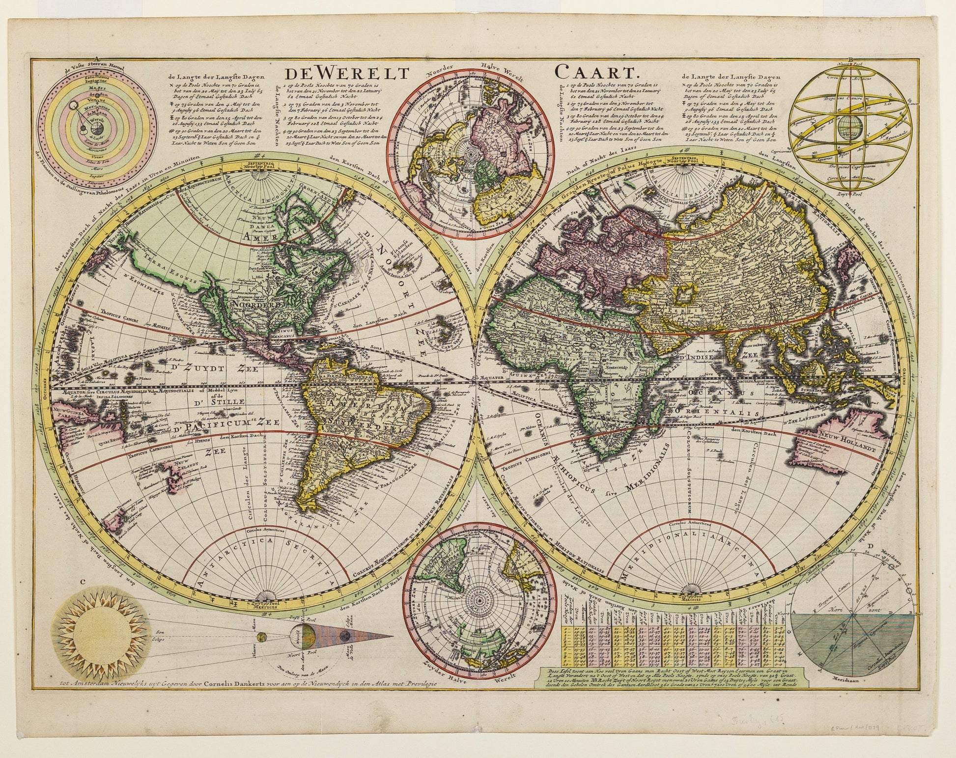
The Danckerts publishing firm was among the most prominent print and map sellers in Amsterdam in the late 17th and early 18th centuries. Cornelis Danckerts was active from the 1690s until his death in 1717. This double hemispheric map uses the most up-to-date information from French sources. The course and tributaries of the Mississippi are charted, while the corners have astronomical diagrams with explanations in Dutch text.
Double hemisphere world map from a Dutch bible by Cornelis Dankerts (Danckerts), engraved by Albert Schut, printed in 1710. California is shown as an island and Terra Esonis stretches from just above California nearly to Asia and the land of Yedso above Japan. North and south polar projections appear at the top and bottom between the spheres. In each upper corner are illustrations of Ptolemaic theory on the revolution of the planets and stars around the earth. In the lower corners are diagrams of the movement of the Sun throughout varying degrees of latitude and a plan of the Sun, Moon and Earth during lunar and solar eclipses. There are extensive notations in Dutch at the top and a keyed table of latitude at the bottom. Dutch text on verso. Source unknown, to be determined.
